The rain in December and January was good. In some areas it was spectacular and in others it was about average. But all in all the Ruaha Park and Usangu area have had more than substantial rains so far this season. Now the middle of February, we have experienced a dry spell which is normal.
From the onset of the rains in early December, the Ruaha River had irregular bursts of flood waters, emanating from the various sand rivers in the Park and also in Usangu. This water flowed for several days at a time, all from local rainstorms, in different sections along its course but it was never a constant flow. The picture below shows the flood water from a rainstorm on the 27th December 2011. This flow lasted a few days only before drying up again. One can tell it is from local flooding due to its brown colour.
From the onset of the rains in early December, the Ruaha River had irregular bursts of flood waters, emanating from the various sand rivers in the Park and also in Usangu. This water flowed for several days at a time, all from local rainstorms, in different sections along its course but it was never a constant flow. The picture below shows the flood water from a rainstorm on the 27th December 2011. This flow lasted a few days only before drying up again. One can tell it is from local flooding due to its brown colour.
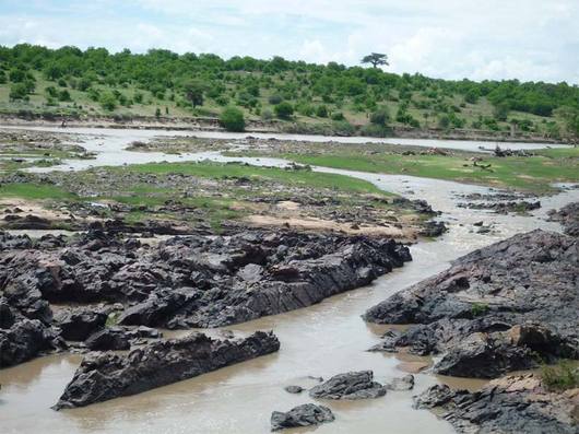
Ruaha River 28th Dec 2011 Ibuguziwa main bridge (old gate)
Then on the 17th of January 2012 the Usangu water came flowing down the river past the bridge at the old entrance gate (Ibuguziwa). This water flowed on to Lunda. We know this is the Usangu water due to its dark almost black colour. See photo below.
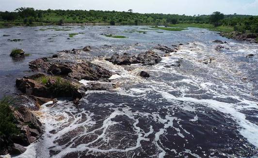
Ruaha River 28th Jan 2012 - Ibuguziwa
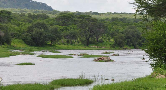
However, as can be seen from the photo below, taken from the same spot some 10 days later, the river level has not risen. Which it should be doing if the water was flowing without interruption or abstraction. Also the water in the photo below is slightly brown, which means that it has mixed with recent floodwater from rainstorms, which we know came from the area just South West of Jongomero. So, even more reason that the water level should be higher than it was on the 28th Jan. Finally...
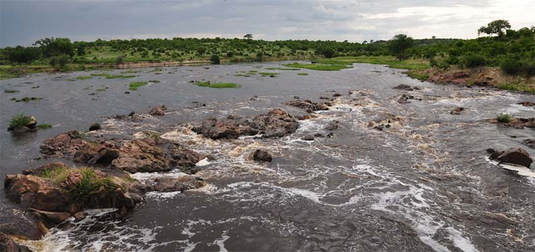
Ruaha River 6th Feb 2012 - Ibuguziwa
The ever present marker stone at my old camp reveals all. If you look at the 2 photos below you can see how low the river actually is. It is about one third as full as it should be.
I suspect that the massive off takes in the Usangu area are greater than ever before. It is no wonder that Mtera Dam is not filling up very fast.
If the water was allow to flow naturally I feel sure that the river and hence the dam would be an awful lot higher than what we are witnessing at present.
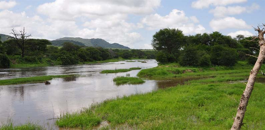
Ruaha River 2nd Feb 2012 Sues camp - Stone marker
Ruaha River 2nd Feb 2012 Sues camp - Stone marker
 RSS Feed
